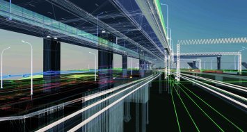
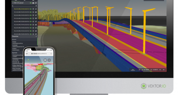
Regarding the extension project for metro line 11 in Paris, Anthony Balbeurre, foreman at Bouygues Construction, is able to rely on a new tool to collect and share data in real time: Infrakit.
An appropriate tool for all phases of the project
During the construction phase, at the Line 11 site, Anthony Balbeurre was able to use Infrakit in combination with a surveying antenna (equipped with an on-board GPS), which allowed him to measure extremely precisely (2 cm accuracy) the work carried out by the machines in the field. Thanks to this centimeter-level precision, he was able to carry out inspections on the work as he progressed, after completing the earthwork or pouring concrete, without having to bring a surveyor/topographer to the site.All this makes it possible for these reception and control surveys to be performed as the work progresses independently. Once these readings are validated to match the design outlines, the work can continue without delay.
Before using Infrakit, the foreman had to complete these surveys using another (unconnected) device and then, at the end of the day, take the time to extract the collected data and pass it on to other stakeholders like the head surveyor. Thanks to the interoperability of the GNSS antenna that they use now, in combination with Infrakit, the transmission of the data happens simultaneously with their input.Infrakit thereby offers significant on-site time savings, even if the acceptance phase (which is an inevitable contractual validation) must still be carried out by a surveyor, who operates with his/her own tools (but, who nevertheless uses Infrakit to update his/her data with the rest of the teams).
Crucial assistance for site managers
Anthony Balbeurre, in charge of earthwork for the extension of metro line 11 clearly explains, “Infrakit helps me get all of the coordinates and designs in real time at my site and, most importantly, I can react immediately, without having to bring a surveyor out to the field. At the beginning of earthwork, I use Infrakit to locate my dirt entrances, as well as my ridges and embankments. During earthworks, Infrakit allows me to know exactly where I am, for example as it relates to altimetry. I can verify that we are in the right place and that we have not ‘eaten up’ the slopes too much, or, to the contrary, left too much material on them.”
For Anthony Balbeurre, being able to do without the daily visit of a surveyor, thanks to Infrakit, is an invaluable time-saver. He explains further, “I don't have to bring the surveyor in all the way or wait for his information to move forward. For example, if I want to implant a sole (concrete bridge foot), thanks to Infrakit, the surveyor can communicate the file directly to me and, in just a few minutes, I get the information and I can go out into the field with my own GNSS antenna.”
Saving time, making work easier, fluid communication and real-time sharing of large amounts of data in a completely interoperable way: Infrakit has a proven track record as a shared data management solution for Subway line 11 Paris.
Other news

Fully custom data processing pipelines
Build custom tools for processing reality data with Pointscene’s new API

Allplan Bridge 2022: The evolution of precast bridge modelin...
Discover a dedicated modeling solution to generate accurate geometry easily and quickly

BIM Infra, a quality approach according to setec
The benefits of BIM Infrastructure are numerous. For a long time, BIM Infrastructure has r...

Infrakit’s owners’ view: schedule, costs and quality
The work environment for which Infrakit was designed for is quite extensive and diverse. M...


